Plaats:Thorn:1867:1: verschil tussen versies
Geen bewerkingssamenvatting |
Geen bewerkingssamenvatting |
||
| Regel 2: | Regel 2: | ||
|kaart={{PAGENAME}} | |kaart={{PAGENAME}} | ||
|impressum={{sys:titeldeel|veld=-2}} | |impressum={{sys:titeldeel|veld=-2}} | ||
|afbeelding=https:// | |afbeelding=https://imsr.ghklandvanthorn.nl/i/Rx2jt.jpg | ||
|afbeelding_groot=https:// | |afbeelding_groot=https://imsr.ghklandvanthorn.nl/i/Rx2j.jpg | ||
|cartograaf=Jacob Kuyper (1821-1908) | |cartograaf=Jacob Kuyper (1821-1908) | ||
|archiefstuk= | |archiefstuk=Rx2j.jpg | ||
|deelarchief_url=https://www.atlas1868.nl/ | |deelarchief_url=https://www.atlas1868.nl/ | ||
|deelarchief=Gemeente Atlas Nederland 1868 | |deelarchief=Gemeente Atlas Nederland 1868 | ||
Versie van 8 aug 2024 11:21

Terug naar Historische kaarten
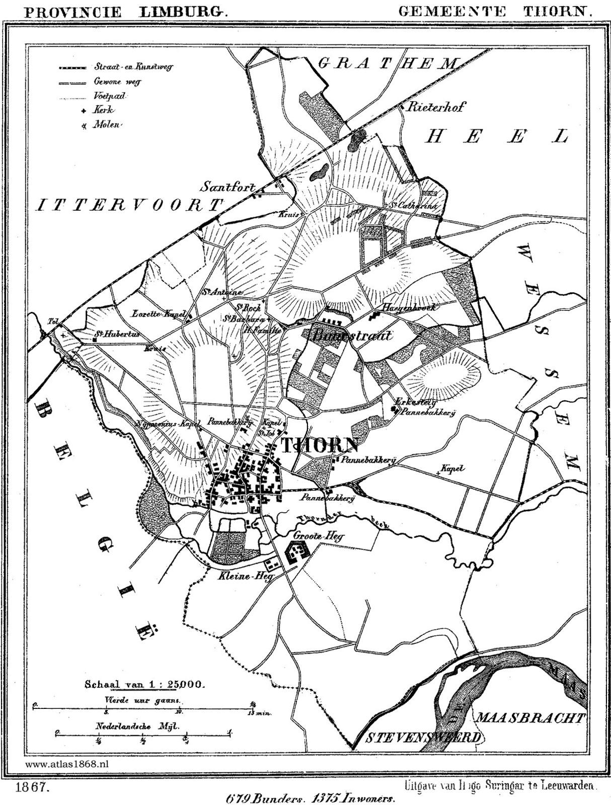
Impressum 1867 1867 - Gemeente Thorn
Cartograaf Jacob Kuyper (1821-1908)
Kaart afkomstig uit Gemeente Atlas Nederland 1868 aanwezig in atlas1868
Categorieën:
- Kaart:Plaats:Thorn
- Cartograaf:Jacob Kuyper (1821-1908)
- Archief:Gemeente Atlas Nederland 1868
- Kaart:Monument:Thorn:De Grote Hegge
- Kaart:Monument:Thorn:De Kleine Hegge
- Kaart:Monument:Thorn:De Kraekermolen
- Kaart:Monument:Thorn:Zeldenrust
- Kaart:Monument:Thorn:Munthuis
- Kaart:Monument:Thorn:Motké, P.H.B. (1826-1872)
- Kaart:Monument:Thorn:Sint-Michaëlkerk
- Kaart:Monument:Thorn:Huize Groenenberg
- Kaart:Monument:Thorn:Kapel Onder De Linden
- Kaart:Monument:Thorn:Huize de Kraek
- Kaart:Monument:Thorn:Kasteelhoeve Hagenbroek
- Kaart:Monument:Thorn:Panhut