1764-1771:1: verschil tussen versies
Geen bewerkingssamenvatting |
Geen bewerkingssamenvatting |
||
| Regel 7: | Regel 7: | ||
|afbeelding_groot=https://imsr.ghklandvanthorn.nl/i/MaiFgHW.jpg | |afbeelding_groot=https://imsr.ghklandvanthorn.nl/i/MaiFgHW.jpg | ||
|cartograaf=Österreichische Niederlande (1764–1771) - First Military Survey | |cartograaf=Österreichische Niederlande (1764–1771) - First Military Survey | ||
|archiefstuk=https:// | |archiefstuk=https://maps.arcanum.com/en/map/firstsurvey-habsburg-netherlands/?bbox=648038.5911035382%2C6648780.946768865%2C653258.3123485197%2C6650947.674806496&map-list=1&layers=153 | ||
|archief_url=http://mapire.eu | |archief_url=http://mapire.eu | ||
|archief=Mapire | |archief=Mapire | ||
Versie van 14 jul 2024 17:34
Terug naar Historische kaarten
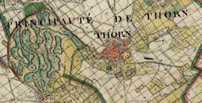
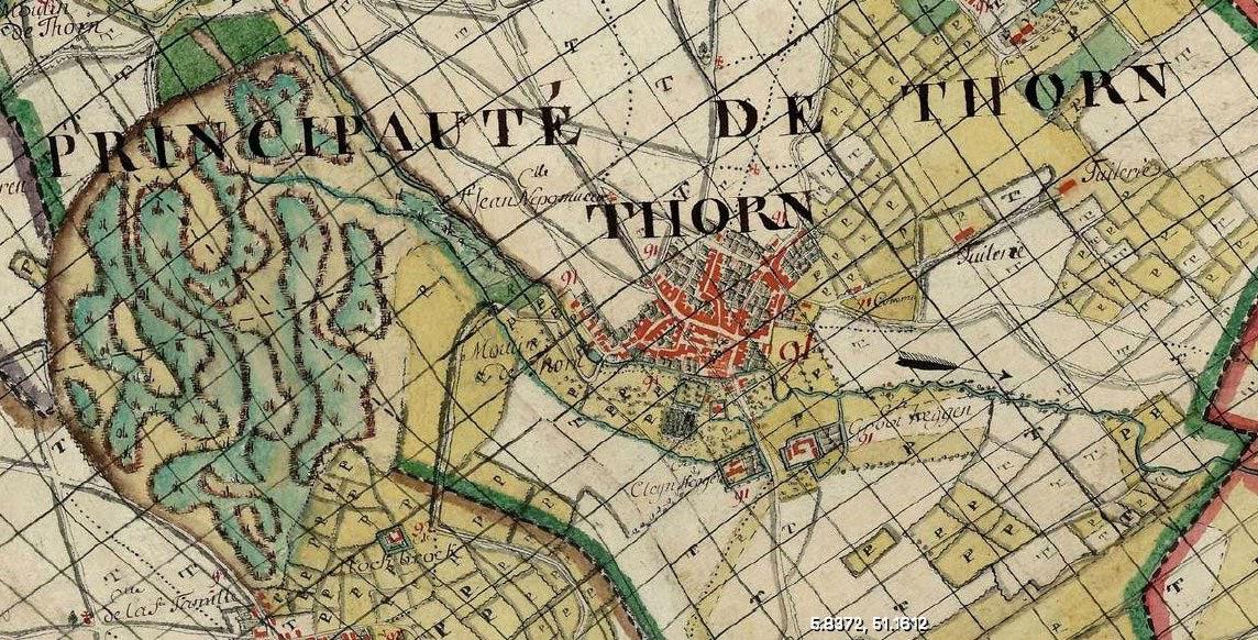
Impressum 1764-1771 (vertaald)Cartograaf Österreichische Niederlande (1764–1771) - First Military Survey
Kaart afkomstig van Mapire